


ACTIVE OUTDOORS: Marching the length of the Hadrian's Wall Path

Mike Merritt gets a closer inspection of the 80-mile Hadrian's Wall on a walking holiday in northern England

So what did the Romans ever do for hikers? Well, they left a remarkable 84-mile long trail to start with. Pity they forgot about the blister plasters!
The Hadrian’s Wall Path is a stunning, rollercoaster national trail stretching coast to coast across northern England, from Wallsend at Newcastle-upon-Tyne in the east to Bowness-on-Solway in Cumbria on the west coast.
The wall has it all – hills, woodland, open moor, river crossings and stiles – in fact, lots of stiles!
It is the largest Roman archaeological feature in Britain and was, in its heyday, as much as 11 feet high and eight feet wide.
The trail follows the line of the Unesco World Heritage Site, passing through some of the most beautiful parts of England – from rolling fields and rugged borderlands to the cities of Newcastle and Carlisle.
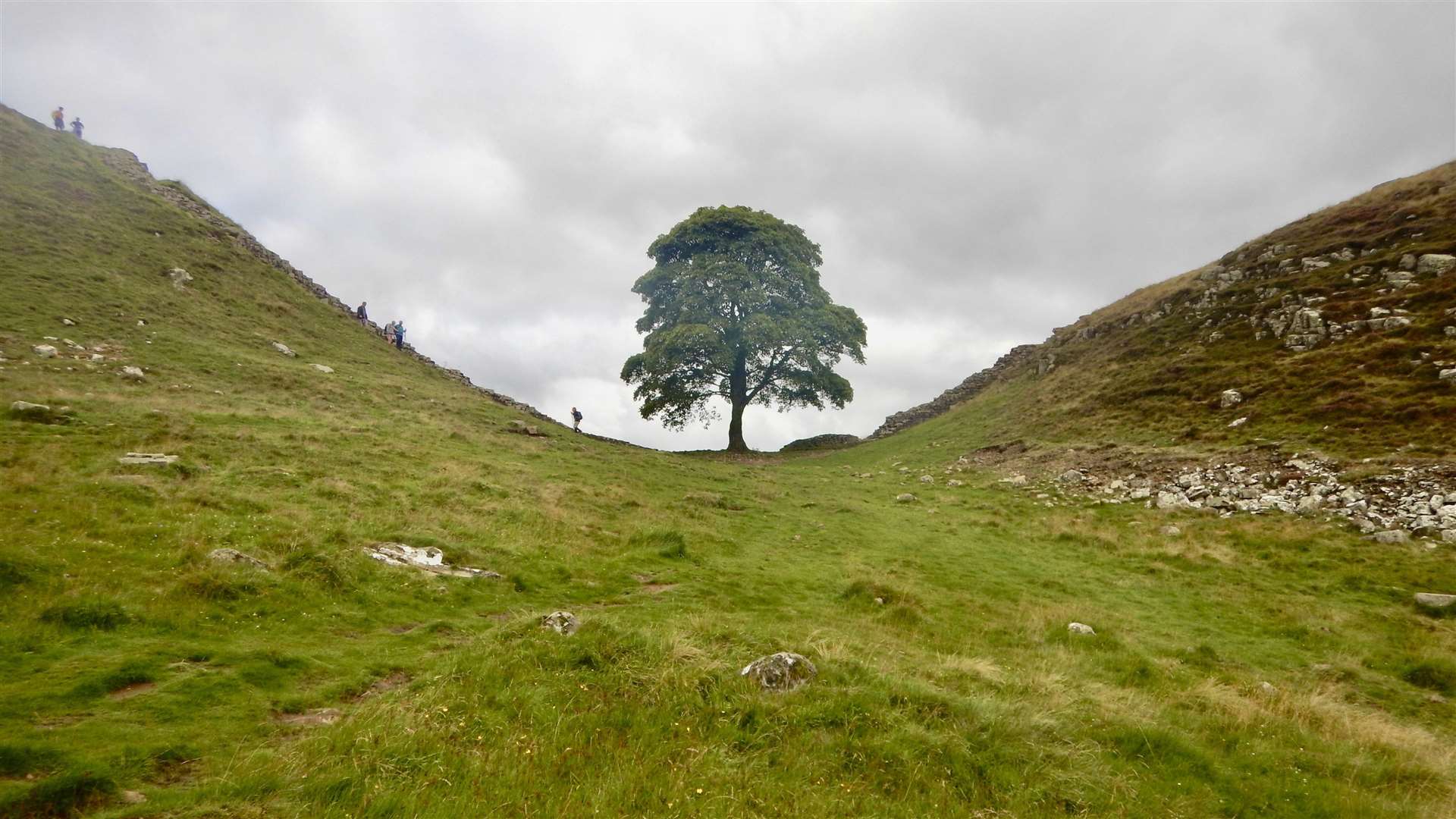
The 23-mile section between Chollerford and Birdoswald is the most difficult, with lots of short climbs and descents, but also the most impressive.

Factor in the Cumbrian weather and it becomes even more challenging. Pack good waterproofs – you will need them.
I joined a HF guided tour with a diverse range of companions that included a retired government vet with an encyclopaedic knowledge, teachers, a top financial guru and two American tourists, to name a few.
No matter how difficult the day, the food was excellent, matching the company.
No matter how different our backgrounds, we were all equals in answering the call of the wall.
It was originally built by Emperor Hadrian from east-to-west, starting in AD122 – the stone wall with large ditches in front of it and behind it that crossed the whole width of the island.

Soldiers were garrisoned along the line in large forts, smaller milecastles and intervening turrets. In addition to the wall's defensive military role, its gates may have been customs posts.
The path generally runs very close to the wall, of which only about nine per cent remains. Almost all of the standing masonry was removed in early modern times and plundered for local roads, walls and farmhouses – as well as churches! None of it stands to its original height.
One of the most impressive examples of the Hadrian's Wall-comprised church buildings is Lanercost Priory, which carries a huge number of Roman stones and many of them bearing Latin inscriptions.
Some of Lanercost's monastic buildings were pulled down in the 16th century and stone from Hadrian's Wall reused again during the building of a new stately home for the Dacre family.
Hadrian's Wall marked the boundary between Roman Britannia and unconquered Caledonia to the north. The wall lies entirely within England and has never formed the Anglo-Scottish border, though it is often loosely or colloquially described as being such.
The turf-built Antonine Wall in what is now central Scotland, which briefly superseded Hadrian's Wall before being abandoned, was declared a World Heritage Site in 2008.

Throughout the length of Hadrian's Wall there was a watch-tower every third of a mile also providing shelter and living accommodation for the Roman troops in these turrets.
The trail is fragile and can become muddy in wet weather, so the best time to walk it is between May and October.
Be warned – you will pass through a lot of fields with cows in, including one that inexplicably warned of a bull at one entrance but not at the other for walkers coming in the opposite direction!
Part of the central section of the wall follows natural cliffs on an escarpment of the Whin Sill rock formation.
The path for the most part is well signposted, but the wall only really emerges after a couple of days.
Built by some 15,000 Roman soldiers, Hadrian’s Wall served as the northern frontier of the Roman empire for 300 years, separating colonised territories from the land still controlled by the Picts. The original wall was 80 Roman miles (73 modern miles) long, with 80 matching milecastles (small forts) and half-a-dozen giant forts that served as armed cities, which the legions continued to defend for four centuries.

It is thought that following construction, and when fully manned, almost 10,000 soldiers were stationed on Hadrian's Wall, made up not of the legions who built it but by regiments of auxiliary infantry and cavalry drawn from the provinces.
Today the route is officially 84 miles.
But our mileage for the week was hard to determine – as we started before Bowness on Solway and took a couple of detours, but some of our party logged 96 miles over six days, with a maximum daily ascent of 1850 feet. I thought we were a touch over 100 miles.
Richard, our genial and experienced guide, daily encouraged us on to "another 8k" which always seemed more like "another eight miles"!
I found it a harder trek than the more popular and officially longer West Highland Way, which at 96 miles attracts an estimated 120,000 people each year – of whom 36,000 walk the the entire route.
The stats for Hadrian's Wall are less crowded – about 30,000 walk parts of it each year and 7000 in one go.
My tips are – walk it west to east, so the prevailing wind (and rain) will be on your back. Take two pairs of boots as the path will often be muddy and wet. Wear galoshes or similar. Be prepared for lots of stiles and cows! And don't rely on drying rooms to get all clothes and footwear ready for the next day. Often they are so crammed with wet clothes the atmosphere becomes very humid, they are almost steam rooms. Boots especially may be better left in rooms to dry.
And take those plasters. I ended up supplying a few to less prepared fellow hikers. The walk is good for the soul and good for the well-prepared sole.
- Mike Merritt went with HF Holidays. The seven-night trip included six days of continuous walking, guided all the way, from the saltmarshes of Bowness in the west to the Roman fort of Segedunum, in the east. It included all accommodation and meals – including packed lunches – costing a total of £1179.
