


OUT AND ABOUT WITH RALPH: Escaping the A9 for high hill above Ralia pitstop
Register for free to read more of the latest local news. It's easy and will only take a moment.


Walks, bike rides, paddles from the A9. One of these days I’ll get round to a book! That familiar road passes through such wonderful country, all the way from Thurso to Stirling and on to Edinburgh or Glasgow.
How can anyone travel that way without the urge to stop and explore?
Even though I’ve visited most of the hills and glens you can see from the road, it is still most frustrating to be stuck in a car on a fine day. I much prefer to be driving when the rain, too, is driving!
But there are some places I’ve never visited, and one such was Creag Dhubh. Never heard of it? Well if you’ve ever stopped at the Hairy Coo at Ralia it rises above the steep slopes of birch woods and crags just to the north.
Indeed, the mountain, almost high enough to be a Corbett, dominates much of the A9 between Kincraig and Dalwhinnie. Every time I’ve passed I’ve resolved to climb the hill. At last I did, but no more than one in ten thousand of those streaming past every day will have done so.

The River Calder blocks access from the north, the southern slopes look very rough and steep, so the obvious approach is from Newtonmore. No paths are marked on any map, strange in such a tourist area as you might expect several well-worn routes up such a prominent hill.
There was just room to park the car near the Calder Bridge by a historic signpost to Banchor Cemetery, amazingly this was once the only surviving Gaelic sign in the whole area. The map suggested that a track from Biallaid would give access to a rising ridge but, as is often the case, the start was the hardest part with no signposts and a maze of private tracks.
Fine birch woods cover the eastern slopes, after the long winter the trees were still leafless and the ground yellow and dead-looking. But there’s nothing like the sight of bare birch branches against a blue sky and, though a bitter wind was blowing from the north, the day was improving.
The high Cairngorm tops were white with fresh snow but otherwise the late-April hills only bore a few streaks and patches.
The track climbed gently through the woods before petering out in rough country of tussock and bog. Obviously few came this way.
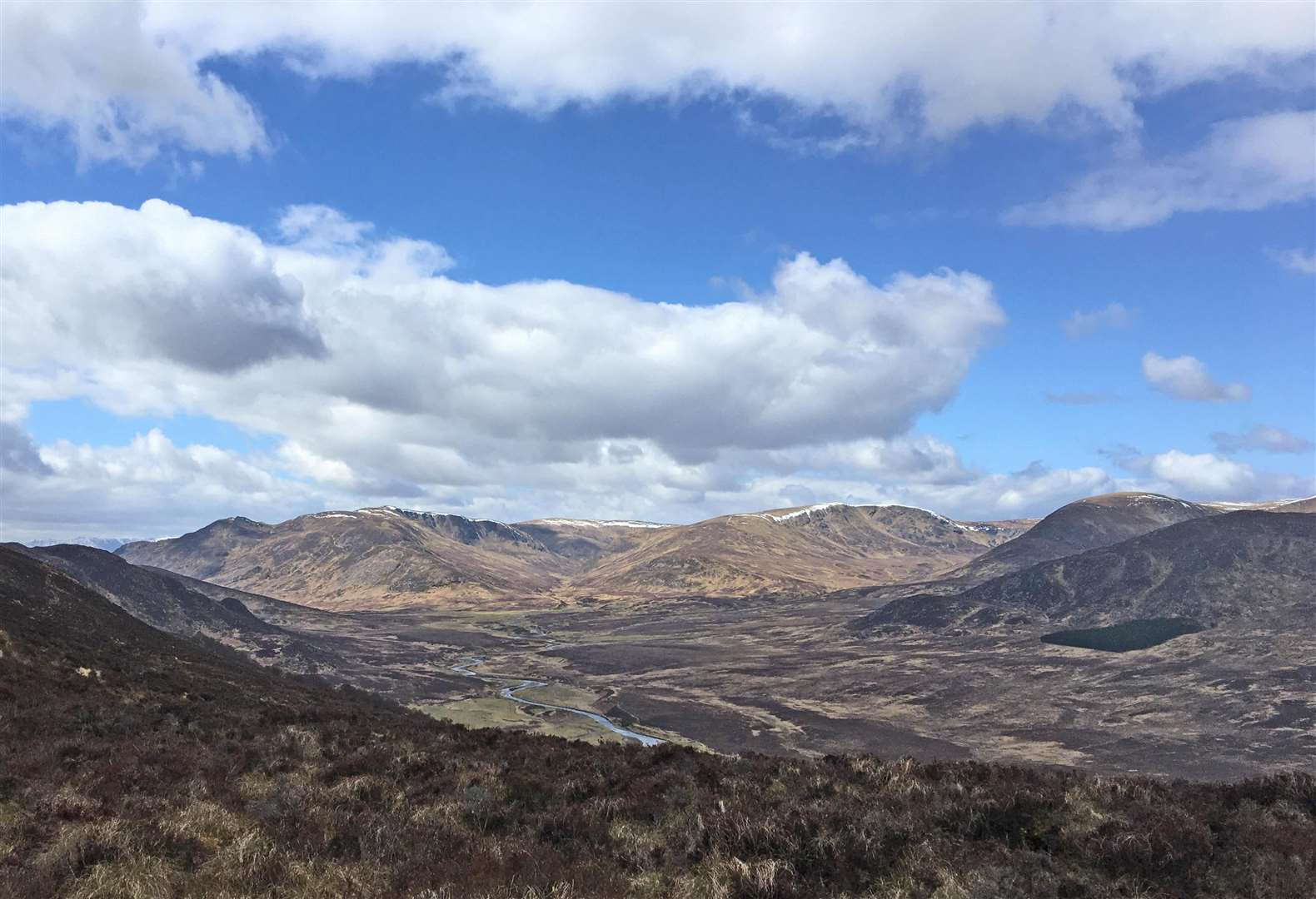
After picking my way on up through deep heather, scattered woods and low crags, a fine view opened out across Glen Banchor to the corries and rolling tops of the high Monadhliadh. Once on the ridge the route was obvious, a few steep climbs and some boggy patches before reaching the eastern top of An Torr, with the main summit visible a mile to the south-west.

A faint path led down to the next boggy depression with a steep climb then an easy walk over a long succession of false tops on an improving path, before the well-built summit cairn finally appeared.
A glorious spot to be, the day now fine and clear with sun and cumulus but still a very bitter wind! Views stretched all the way up the A9 from Drumochter to Aviemore, west to the high tops of Ben Alder and Ardverikie, east to the Feshie Hills and the high Cairngorms, with glimpses of the Gaick and the Minigag Pass, all places with many memories. Best of all was to look down on Ralia and those moving dots on the main road, and not for once be stuck down there looking up!
Retracing my steps, I kept on along a reasonably clear path which took a slightly more southerly route before a very steep and slippery descent into the birch woods. Here was a wild goat, with a young kid which must have been recently born.
The trod, more of a route than a good path, led on down, eventually emerging onto the track just above Biallaid, where an inconspicuous mossy cairn marked the start, which I’d missed on the way up.
I stopped to check my clothes for ticks, you never know, even in such cold weather and yes, there was the first one of the year. Back at the car the walk had taken me nearly five hours but I had been very slow, an average runner from Newtonmore would do it in a third of that time. A fit person could well climb the peak to break a long journey rather than have a sleepy stop at Ralia. Those 9999 who never do, well, their lives are the worse for it. Creag Dhubh is a very fine hill.